White Christmas Odds by City: US and Canada
NOAA's 1991-2020 odds of an inch of snow on the ground on December 25, ECCC's 70-year Canadian record, and when to start trusting the Christmas snow forecast.
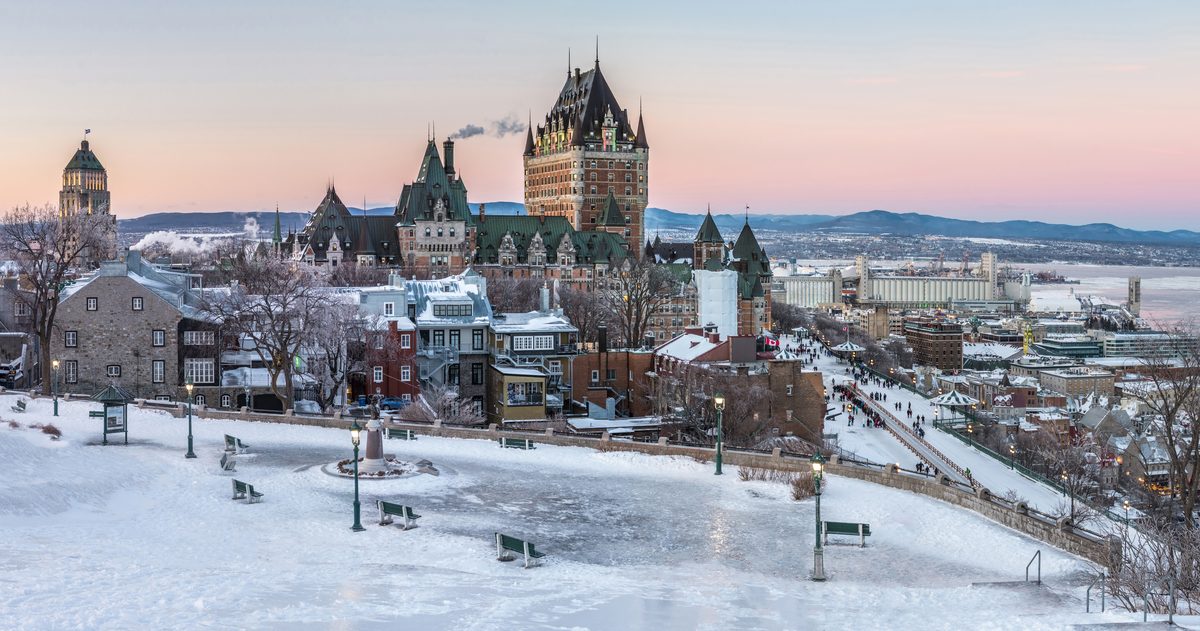
Your odds of a white Christmas depend almost entirely on where you live. On NOAA's 1991-2020 climate normals, Duluth has a 92% chance of at least 1 inch (2.5 cm) of snow on the ground on December 25 and Minneapolis 74%, but Chicago only 34%, New York City 13% and Seattle 4%. In Canada, Environment and Climate Change Canada (ECCC) records give Winnipeg a 99% chance of at least 2 cm (0.8 in) on Christmas morning, Ottawa 79%, Toronto 44% and Vancouver 10%.
What counts as a white Christmas in the US, Canada and the UK?
The three countries measure different things, so their odds cannot be compared directly.
| Country | Official definition | Set by |
|---|---|---|
| United States | At least 1 inch (2.5 cm) of snow on the ground at 7 a.m. local time on Christmas Day | National Weather Service |
| Canada | At least 2 cm (0.8 in) of snow on the ground on Christmas morning, at "7 a.m. EST" in ECCC's wording | Environment and Climate Change Canada |
| United Kingdom | A single snowflake observed falling during the 24 hours of December 25, by a Met Office observer or automated station | Met Office |
The American and Canadian definitions are about snow lying on the ground, not snow falling. Snow that falls on December 20 and is still there at 7 a.m. on the 25th counts, while a snowstorm that starts at noon on Christmas Day does not. ECCC also tracks a "perfect Christmas": at least 2 cm on the ground in the morning and measurable snow falling at some point during the day.
The British definition is far looser. Since 1960, the Met Office says, around half of years have had snow falling at 5% or more of its stations on Christmas Day, yet a widespread covering on the ground (more than 40% of stations at 9 a.m.) has happened only four times: 1981, 1995, 2009 and 2010. UK readers can find the odds in will the UK have a white Christmas?
What are the odds of a white Christmas in US cities?
NOAA's National Centers for Environmental Information (NCEI) publishes the historic probability of at least 1 inch of snow on the ground on December 25 for each weather station, based on the 1991-2020 U.S. Climate Normals. The table shows major cities from the most to the least likely, with each station's December normals for context.
| City | NOAA station | Chance of 1 in+ on the ground, Dec 25 | December snowfall | December avg high |
|---|---|---|---|---|
| Anchorage | Anchorage Intl Airport | 93.7% | 18.2 in (46 cm) | 25.0°F (-3.9°C) |
| Duluth | Duluth | 92.2% | 18.7 in (47 cm) | 24.7°F (-4.1°C) |
| Minneapolis-St. Paul | Minneapolis/St. Paul Airport | 73.6% | 11.4 in (29 cm) | 28.8°F (-1.8°C) |
| Buffalo | Buffalo | 52.7% | 25.3 in (64 cm) | 37.2°F (2.9°C) |
| Salt Lake City | Salt Lake City Intl Airport | 47.9% | 12.1 in (31 cm) | 39.0°F (3.9°C) |
| Denver | Denver-Stapleton (NOAA's long-running Denver station) | 34.0% | 6.6 in (17 cm) | 45.9°F (7.7°C) |
| Chicago | Chicago O'Hare Intl Airport | 33.5% | 7.6 in (19 cm) | 36.6°F (2.6°C) |
| New York City | Central Park | 13.2% | 4.9 in (12 cm) | 44.3°F (6.8°C) |
| Seattle | Seattle-Tacoma Intl Airport | 3.7% | 1.7 in (4 cm) | 47.0°F (8.3°C) |
| Boston | Boston Logan Intl Airport | no value (insufficient data) | 9.0 in (23 cm) | 42.2°F (5.7°C) |
December snowfall is the snow that falls during the month; the percentage is about snow lying on the ground on the 25th. NOAA's spreadsheet marks Boston Logan as missing because of insufficient data, so we show no figure rather than borrow one from another town. NOAA's own analysis puts the best odds in Minnesota, Maine, Upstate New York, the Allegheny Mountains of Pennsylvania and West Virginia, almost anywhere in Idaho, and the Rockies and Sierra Nevada, where Crested Butte, Colorado, is one of a handful of stations with a probability near 100%. NOAA also warns that any single year can differ widely from these figures, because the weather pattern decides what is on the ground.
Why does Buffalo get more snow but fewer white Christmases than Minneapolis?
Because the definition is about snow that stays, not snow that falls. Buffalo averages 25.3 inches of snow in December, more than twice Minneapolis's 11.4 inches, yet its Christmas odds are 52.7% against 73.6%. The clearest difference in the normals is temperature: Buffalo's December high averages 37.2°F (2.9°C), above freezing, while Minneapolis averages 28.8°F (-1.8°C). The NOAA normals show the result. Minneapolis averages 20.9 December days with at least an inch on the ground, Buffalo 14.4.
The same logic explains Denver. It gets snow, but with a December high of 45.9°F (7.7°C), snow on the ground often does not last until the 25th, so the odds are only about 1 in 3. Seattle averages only 1.7 inches of December snow and 1.3 days with an inch on the ground, which is why its chance is under 4%.
What are the odds of a white Christmas in Canadian cities?
ECCC has analyzed 70 years of records, 1955 to 2024, for 45 major centers. Its table gives the full-period chance and two 25-year windows, so you can see how the odds have moved.
| City | Chance, 1955-2024 | Chance, 2000-2024 | Chance, 1961-1985 | Avg snow on the ground, Christmas morning 2000-2024 |
|---|---|---|---|---|
| Winnipeg | 99% | 100% | 100% | 15 cm (5.9 in) |
| Ottawa | 79% | 72% | 84% | 18 cm (7.1 in) |
| Montreal | 74% | 72% | 84% | 8 cm (3.1 in) |
| Calgary | 61% | 68% | 68% | 6 cm (2.4 in) |
| Halifax | 51% | 36% | 68% | 3 cm (1.2 in) |
| Toronto (city station) | 44% | 44% | 56% | 5 cm (2.0 in) |
| Vancouver | 10% | 8% | 8% | 2 cm (0.8 in) |
Snow on the ground is not the same as snow in the air. Winnipeg has had a white Christmas in 99% of years, but a "perfect Christmas", with snow also falling during the day, in only 11% of years from 1955 to 2007. Ottawa managed 35% and Toronto 9%. Across all 45 centers the perfect-Christmas average is 31%.
Are white Christmases getting less common in Canada?
ECCC's table says yes for most cities. Averaged across its 45 centers, the chance of a white Christmas was 79% in 1961-1985 and 66% in 2000-2024. The average number of green Christmases per city rose from 8 in the 35 years from 1955 to 1989 to 12 in the 35 years from 1990 to 2024.
- Biggest fall among the cities above: Halifax, from 68% to 36%.
- Ottawa and Montreal: both down from 84% to 72%.
- Toronto: down from 56% to 44%.
- No change: Winnipeg (100%), Calgary (68%) and Vancouver (8%).
The US figures cannot show a trend on their own, because NOAA's probabilities are a single 1991-2020 average.
How far ahead can you trust a snow forecast for December 25?
About a week for the first real forecast, and about two days for the amounts. Both national weather services forecast seven days ahead: the National Weather Service point forecast runs a full week, and ECCC says that because its forecast covers the next seven days, the Christmas Day forecast is available from December 19. Before that, only outlooks exist.
- Early December: use the odds above. They are the honest baseline.
- From about December 11: NOAA's Climate Prediction Center 8-14 day outlook reaches Christmas. It gives the chance that the whole period averages above, near or below normal against 1991-2020, not a forecast for the 25th. The Week 3-4 outlook only offers above normal, below normal or equal chances.
- December 18-19: Christmas Day enters the NWS and ECCC 7-day forecasts.
- December 22-24: NOAA's Weather Prediction Center issues probabilities for Days 1 to 3 of at least 1, 2, 4 inches and more of snow. Now check what is already on the ground: with a white-Christmas definition based on snow cover, existing snow plus a cold forecast is the strongest signal you will get.
Our own measurements show why the week matters. Across 40 US cities between September 11 and October 6, 2026, the European model's temperature forecast was off by an average of 1.68°F (0.93°C) one day ahead and 4.13°F (2.29°C) seven days ahead. Our forecast accuracy by day page has the current figures, and our guide to reading a snow storm forecast explains why a storm is usually clear four to five days out while totals and the rain-snow line only firm up within about two days. Each city in the tables above links to a page that puts the forecast models side by side, so you can see whether they agree on snow for the 25th.
A white Christmas is mostly decided by geography and by the week before. Check the odds for your city now, watch the 8-14 day outlook in mid-December, and trust the forecast once Christmas Day is inside the seven-day window.