Weather symbols and icons explained: what each one means
Sun, cloud, raindrop and snowflake look the same in every app, but the rules behind them do not. What each icon means, what the number under it is, and where the US, UK and Australian sets disagree.
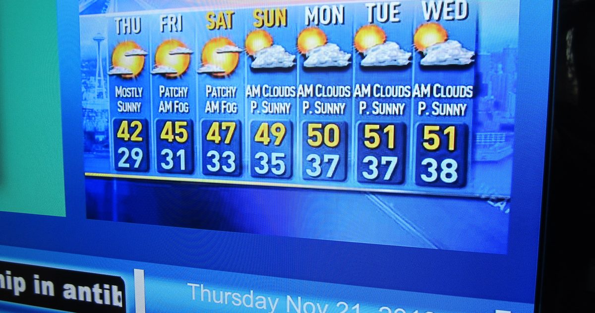
Weather symbols are shorthand for the main weather in a forecast period: a sun means clear or sunny, a sun partly behind a cloud means partly cloudy, a plain cloud means cloudy, raindrops mean rain (more drops or longer streaks mean heavier), a snowflake means snow, a lightning bolt means thunder, and horizontal lines mean fog, mist or haze. A moon takes the sun's place at night. A percentage next to a raindrop is the chance of precipitation, not how much will fall.
The pictures look alike everywhere; the rules behind them do not. "Sleet" means ice pellets to the US National Weather Service (NWS) and a mix of rain and snow to the UK Met Office. The Met Office has no haze symbol, while Australia's Bureau of Meteorology (BOM) has icons for frost, dust and cyclones.
What do the common weather symbols mean?
| Symbol | Meaning | How it differs by app or country |
|---|---|---|
| Sun (moon at night) | Clear or sunny | The NWS says Fair by day (opaque cloud over less than 3/8 of the sky, and no precipitation) and Clear at night. MetService (New Zealand) calls it Fine: the sun casts a shadow most of the time. |
| Sun or moon partly behind a cloud | Partly cloudy | The Met Office calls the day version Sunny intervals. The NWS has five sky steps: Fair, A Few Clouds, Partly Cloudy, Mostly Cloudy, Overcast. |
| Cloud | Cloudy | The Met Office uses a darker cloud for Overcast. MetService means cloud over about 70 to 100% of the sky for most of the day. |
| Cloud with small drops, or the word Drizzle | Drizzle: drops under 0.02 inch (0.5 mm) across | The Met Office prints the word Drizzle under a cloud. Apple uses one icon for drizzle and freezing drizzle. |
| Cloud with raindrops | Rain | Met Office: one drop is light rain, two drops heavy rain. Apple draws heavy rain as longer streaks. |
| Sun or moon peeking out of a rain cloud | Showers: rain that starts and stops, with drier, often sunny spells between | The Met Office draws showers this way. The BOM does for Shower and Light shower, but its Heavy shower icon has no sun. MetService shows a sun only for Few Showers. The NWS uses a showers photo with blue sky when cloud cover is under 60%. |
| Raindrop and snowflake | Sleet | US: ice pellets that bounce. UK: rain and snow falling together. Apple shares one icon for freezing rain, sleet and wintry mix. |
| Snowflake | Snow | Met Office: two flakes means heavy snow. Apple: a cloud with many flakes means heavy snow or blizzard. |
| Cloud with a lightning bolt | Thunderstorm | The Met Office separates a thunder shower (sun or moon showing) from thunder. The BOM calls its icon Storm. |
| Horizontal lines | Fog, mist or haze | Each set draws them its own way, as the fog section below shows. |
| Wind lines or a windsock | Windy or breezy | The Met Office has no wind symbol: it shows an arrow and a speed. MetService uses its wind icon only when wind is the most important part of the weather. |
Lines with triangles or half-circles along them are not forecast icons at all. They are fronts on a weather map, covered in what a weather front is and how to read one.
What does the percentage under the raindrop mean?
It is the chance of precipitation: the probability that rain, snow or other precipitation falls at your location during that hour or period. It says nothing about how much will fall or for how long. The Met Office explains that 70% means a 7 in 10 chance, and it counts at least 0.004 inch (0.1 mm) in the hour on its hourly forecast, or 0.012 inch (0.3 mm) in three hours on the three-hourly one. On the iPhone, the figure depends on where you look. Apple's developer documentation for the Apple Weather service, which supplies the app's 10-day forecast, defines the hourly figure as "the probability of precipitation during the hour" and the daily figure, shown in the 10-day list, as the probability "during the day".
The NWS prints the number on the icon itself, which shows how little the picture alone tells you. Three NWS point forecasts issued on the morning of October 12, 2026:
| NWS forecast | Icon and number | What the forecast text adds |
|---|---|---|
| Portland, Maine, Tuesday, October 13 | Rain, 90% | Rain mainly after 10am; a quarter to half an inch (6 to 13 mm) |
| Juneau, Alaska, Monday, October 12, as shown at 6:35am AKDT | Split rain icon, 60% then 30% | Rain likely, mainly before 7am; less than a tenth of an inch (2.5 mm) |
| Miami, Monday, October 12 | Blue sky with a shower, 30% | Mostly sunny; showers and storms mainly between 4pm and 5pm |
The 90% in Portland is about whether it rains; the quarter to half inch is about how much. The split Juneau picture is an NWS "dual icon", used since 2015 to show rapidly changing weather in six-hour halves. For the full rules behind the number, see what chance of rain actually means, the Met Office version or the BOM version.
Why does sleet mean something different in the US and the UK?
In the US, sleet is ice pellets: frozen or mostly frozen raindrops that usually bounce when they hit the ground, in the words of the NWS glossary. Freezing rain is different again. It falls as liquid and freezes into a glaze on contact, and the NWS warns that even small amounts can cause significant travel problems. In the UK, the Met Office says sleet has no internationally agreed definition and is reported in observations as rain and snow mixed, which is why its sleet symbol is simply a raindrop beside a snowflake.
The gap matters most on an iPhone, because Apple uses a single icon for freezing rain, sleet and wintry mix. The Weather Company's developer code list, by contrast, keeps Rain/Sleet, Sleet, Freezing Rain and Wintry Mix as separate entries. If you see Apple's mixed icon in winter, read the text label and the hourly temperature before deciding whether the roads will be wet or glazed. In the US, the NWS ladder of winter storm watches, warnings and advisories is the better guide.
Fog, mist or haze: what do the horizontal lines mean?
Lines across an icon mean something is cutting visibility. Fog and mist are water droplets: the World Meteorological Organization (WMO) calls it fog when visibility is below about 0.6 mile (1 km), and mist when it is not. US observers draw the fog line at 5/8 mile, practically the same distance. The Met Office uses 1 km for aviation, but in its public forecasts fog generally means visibility below about 200 yards (180 m), so its Fog symbol means much thicker fog. The NWS issues a Dense Fog Advisory at a quarter mile or less. Haze is dry: a suspension of extremely small particles such as dust, smoke or pollution. Each set draws the difference its own way:
- Apple: a cloud above lines is fog; a sun above lines is haze.
- Met Office: separate Mist and Fog symbols, both plain gray lines, darker for fog, and no haze symbol.
- BOM: Fog and Hazy are both a sun behind horizontal bands, pale for fog and brownish for haze.
- NWS: one Fog/Mist picture for both, and a separate Haze picture that has no night version.
How do Apple, Google, the NWS, Met Office and BOM icon sets differ?
Mostly on haze and sleet. The Google and Weather Company lists are the ones they publish for developers of their weather APIs.
| Icon set | Size | Haze icon? | Sleet icon? | Worth knowing |
|---|---|---|---|---|
| NWS (US) | 70 pictures, day and night | Yes, day only | Ice Pellets (US sleet) | Photographs, not drawings, such as car headlights in fog; in use since July 7, 2015, after 6,700 public comments |
| Met Office (UK) | 30 symbols | No | Yes: rain and snow | Each symbol covers the time shown until the next column |
| BOM (Australia) | 17 icons | Yes (Hazy) | No | Frost, Dusty, Windy and Cyclone icons |
| MetService (New Zealand) | 14 icons | No | No | Frost means below 32°F (0°C) with no precipitation; a combined Wind and Rain icon |
| Apple Weather | 18 in Apple's key; 34 conditions for developers (WeatherKit) | Yes | One icon for freezing rain, sleet and wintry mix | WeatherKit splits isolated thunderstorms (under 1/8 of the area) from scattered (up to 50%) |
| Google Maps Platform Weather API | 40 condition types | No, and no fog or smoke | No ice-pellet type; its rain and snow type matches UK sleet | Day and night versions |
| The Weather Company developer API | 48 codes, 0 to 47 | Yes, plus Smoke and Foggy | Yes, plus Rain/Sleet and Wintry Mix | Code 44 means Not Available |
Why does the icon show rain when the day stays dry?
Because one picture has to stand for a whole period, and some sets show only the most important weather: MetService switches to its wind icon only when wind is the most important part of the day. So a daily rain icon can mean a single shower at 4pm: the Miami forecast above carried a showers icon on a day the NWS also called mostly sunny. Two habits fix most surprises:
- Open the hourly view. On the Met Office forecast, the 9am symbol covers 9am until the next column, so the hourly icons show when the wet spell is.
- Read the percentage and the amount together, as in the Portland example.
Apps can also disagree with each other, because they draw on different forecast models and then pick an icon from the result. When one app shows sun and another shows rain for the same hour, that can be a sign the underlying models disagree; why weather forecasts disagree explains how, and our city forecasts put the sources side by side.
The short version
Learn the handful of shapes, remember that sleet and haze change meaning with the country and the app, and treat the percentage as a probability rather than an amount. The icon is a summary of the forecast, not the forecast itself; when it and the sky disagree, the hourly details usually show why.