Sleet vs snow vs freezing rain vs hail: what is the difference?
One word with two meanings, and four kinds of falling ice that depend on a layer of air you cannot see. A Canada-first guide, with the US and UK terms alongside.
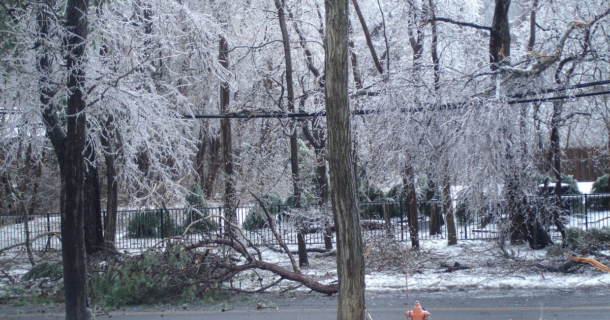
Snow falls frozen all the way to the ground. Ice pellets, which the US National Weather Service calls sleet, start as snow, partly melt in a warm layer of air aloft and refreeze into small grains that bounce. Freezing rain melts completely and then freezes on contact with roads, trees and power lines at or below 0°C (32°F). Hail is something else again: ice that grows inside thunderstorms, mostly in summer. One more twist: in the UK, sleet means rain and snow falling together, and Environment Canada's glossaries and forecast guide do not use the word at all.
Why does sleet mean two different things?
Because nobody ever agreed on it. The Met Office says plainly that sleet "has no internationally agreed definition". Here is how the three national services use it:
- Canada (ECCC): the word does not appear in Environment and Climate Change Canada's weather glossary, its climate glossary or its guide to public forecasts. The Canadian term is ice pellets: transparent or translucent grains of ice 5 mm or less across that usually bounce off hard ground and make a sound when they hit.
- United States (NWS): sleet is "rain that turns to ice pellets before reaching the ground". Same thing as Canada's ice pellets, different name.
- United Kingdom (Met Office): sleet is reported as a mix of rain and snow, precipitation that has started melting before it lands, so you see raindrops and snowflakes falling together.
So sleet in a US forecast means pellets that rattle on the windshield, while sleet in a British forecast means wet, half-melted snow. In Canada, read "ice pellets" and you know exactly which one is coming.
How does each type form? It depends on the air above you
The thermometer at ground level only tells half the story. In ECCC's description of a freezing rain storm, the atmosphere must be "properly layered": a layer of air above freezing aloft, sandwiched between colder layers. How warm and how deep that middle layer is decides what lands. The National Weather Service gives the numbers:
| Type | Warm layer aloft | Air near the ground | What lands |
|---|---|---|---|
| Snow | None, or only a very shallow layer peaking below about 1°C (34°F), which gives wet snow | Below freezing | Snowflakes |
| Ice pellets (US: sleet) | Thin, under about 600 m (2,000 ft), peaking at 1 to 3°C (34 to 38°F), so flakes only partly melt | A cold layer below that refreezes them | Hard grains that bounce |
| Freezing rain | Warmer than 3°C (38°F) at its peak, so flakes melt completely | A shallow sub-zero layer: drops cool below 0°C but stay liquid | Rain that freezes into a glaze on contact |
| Freezing drizzle | Often none: the drops form and stay liquid in a cloud below 0°C throughout. Sometimes a warm layer, as for freezing rain | Below freezing | Drops smaller than 0.5 mm that freeze on contact |
Freezing drizzle breaks the layer rule. Studies cited by the NWS office in Juneau, Alaska, found that 25 to 40% of freezing precipitation events had no above-freezing layer aloft: the drops grew and stayed liquid inside a cloud below 0°C throughout (the supercooled warm rain process). So freezing drizzle can fall when the whole sky is colder than 0°C.
The margins are tiny. ECCC calls forecasting freezing rain "tricky" for exactly this reason: "a one-degree temperature swing on either side of freezing can make all the difference" to what falls. Our guide to reading a snow storm forecast shows how far that line can move between model runs. The setup is common here: ECCC describes ice storms as a major hazard everywhere in Canada except the North, and especially common from Ontario to Newfoundland.
What are Environment Canada's freezing rain warning criteria?
There is no fixed number of hours any more. Since 26 November 2025, every ECCC alert carries a colour, and ECCC says its new Weather Impact Guides "replace the former criteria for public weather alerts". Instead, forecasters judge the likely impact and how confident they are. For ice (freezing rain, freezing drizzle and flash freeze) the guide describes three levels:
- Moderate: travel delays from icy routes and collisions, ice building up on power lines and bridges, some outages, broken branches.
- High: significant delays and multiple collisions, damage to power lines, widespread outages, major property damage and falling trees.
- Extreme: pileups, collapsing utility poles and towers, long and widespread outages, critical infrastructure compromised.
Impact and forecast confidence then set the colour, using ECCC's Alert Colour Matrix:
- Yellow: moderate impact with high or very high confidence, high impact with low or moderate confidence, or extreme impact with low confidence.
- Orange: high impact with high or very high confidence, or extreme impact with moderate or high confidence.
- Red: extreme impact with very high confidence. ECCC says red alerts are rare.
So an ice storm that could be extreme but is still uncertain starts as yellow. The ladder of statements, advisories, watches and warnings is still there, as explained in our guide to ECCC warnings, watches and special weather statements.
Under the old rules (ECCC's criteria page in 2024), a freezing rain warning needed freezing rain that was a hazard to travel or property or lasted at least two hours, four in Atlantic Canada and the Magdalen Islands. A freezing drizzle advisory needed eight hours.
When does the US issue an Ice Storm Warning?
The NWS says Ice Storm Warnings are "usually issued for ice accumulation of around 1/4 inch or more", about 6 mm. Each forecast office sets its own figure, measured on an elevated flat surface, and the national map in NWS Instruction 10-513 shows a quarter inch across most of the lower 48 states and half an inch (about 13 mm) across much of the Northeast. Heavy sleet, which the NWS defines as ice pellets covering the ground 1/2 inch (13 mm) deep or more, counts toward a Winter Storm Warning against local criteria, and lighter snow, sleet or ice gets a Winter Weather Advisory. Watches go out at 50 per cent or greater confidence; warnings and advisories at 80 per cent or more. The full sequence is in winter storm warning vs watch vs advisory, and the lighter end in what a Winter Weather Advisory means.
What happened in the 1998 ice storm?
ECCC's senior climatologist called it the worst ice storm to hit Canada in recent memory. A low over the Texas panhandle pumped warm, moist Gulf air north at cloud level while a large Arctic high over Hudson Bay drained cold air into the St. Lawrence and Ottawa River valleys. A high near Bermuda blocked the usual storm track, so the layered setup stayed unchanged through the week. ECCC's totals for 5 to 10 January 1998, mostly freezing rain and ice pellets, are melted water, not the thickness of the ice on the wires:
| Place | Precipitation as water, 5 to 10 January 1998 |
|---|---|
| Cornwall | 108 mm |
| Montreal | 100 mm |
| Ottawa | more than 85 mm |
| Kingston | 73 mm |
Earlier major ice storms, Ottawa in December 1986 and Montreal in February 1961, left 30 to 40 mm, about half as much by ECCC's count. Ottawa and Montreal normally see freezing precipitation on 12 to 17 days a year, totalling 45 to 65 hours; in 1998 there were more than 80 hours in one storm. ECCC counted 130 major transmission towers and about 30,000 wooden poles down, with more than four million people in the dark. Veterans Affairs Canada puts the toll at roughly 35 Canadian deaths, almost 1,000 injuries and more than 600,000 people temporarily displaced. The Colorado low, the storm track that carries Gulf of Mexico moisture north into Ontario, is covered in Canadian winter storms explained.
What is the difference between hail and graupel?
- Hail grows inside thunderstorms. Updrafts carry raindrops high into very cold air, where they collect supercooled droplets in layers until they are too heavy to hold up. NOAA says golf-ball hail (4.4 cm) needs an updraft of about 103 km/h (64 mph). ECCC defines hail as 5 to 50 mm or more and notes it is most frequent in summer. In the US, hail of 2.5 cm (1 inch) or more makes a storm severe.
- Graupel, or snow pellets, is soft by comparison: white, opaque grains about 2 to 5 mm across that are brittle and easily crushed. ECCC notes they always fall in showers, often with snowflakes or raindrops when it is around 0°C, and tend to bounce and break up on hard ground.
Ice pellets are the easiest to confuse with graupel. The test: ice pellets are clear or translucent and hard; graupel is white and squashes between your fingers.
How do you read it on a Canadian forecast?
- "Risk of freezing rain" is a defined term. ECCC uses "risk" for freezing rain, freezing drizzle, hail and thunderstorms when the chance is 30 or 40 per cent, and leaves the number out.
- Days three to seven are simplified. The extended forecast only uses rain, snow, drizzle, showers, flurries and thunderstorms, and adds freezing rain only when more than 5 mm is forecast. So ice pellets, and freezing rain of 5 mm or less, will not show up beyond day two.
- Check again on the day. ECCC revises a forecast when the expected precipitation type changes, for example from snow to rain or freezing rain.
- Read the alert text, not just the colour. ECCC asks people to read the full alert whatever its colour, because that is where the actions are.
When temperatures sit near 0°C, the models are worth a look. On our Ottawa forecast page, Environment Canada's GEM model, the European ECMWF and the American GFS sit side by side, with each model's hour-by-hour precipitation for the next 24 hours and a flag on every day where they split. If the models land on different sides of 0°C, so does the type of precipitation, and the forecast deserves the next update.
Four types, then, and one confusing word. Snow stays frozen, ice pellets refreeze on the way down, freezing rain waits until it lands, and hail is a summer storm's work. If a forecast says sleet, check which country wrote it.