Lapland, Tromsø and Iceland in Winter: Cold, Daylight, Snow and Aurora
Official 1991-2020 station averages for December to March, sunrise and sunset from the US Naval Observatory, and why the cloud forecast matters more than the aurora forecast.
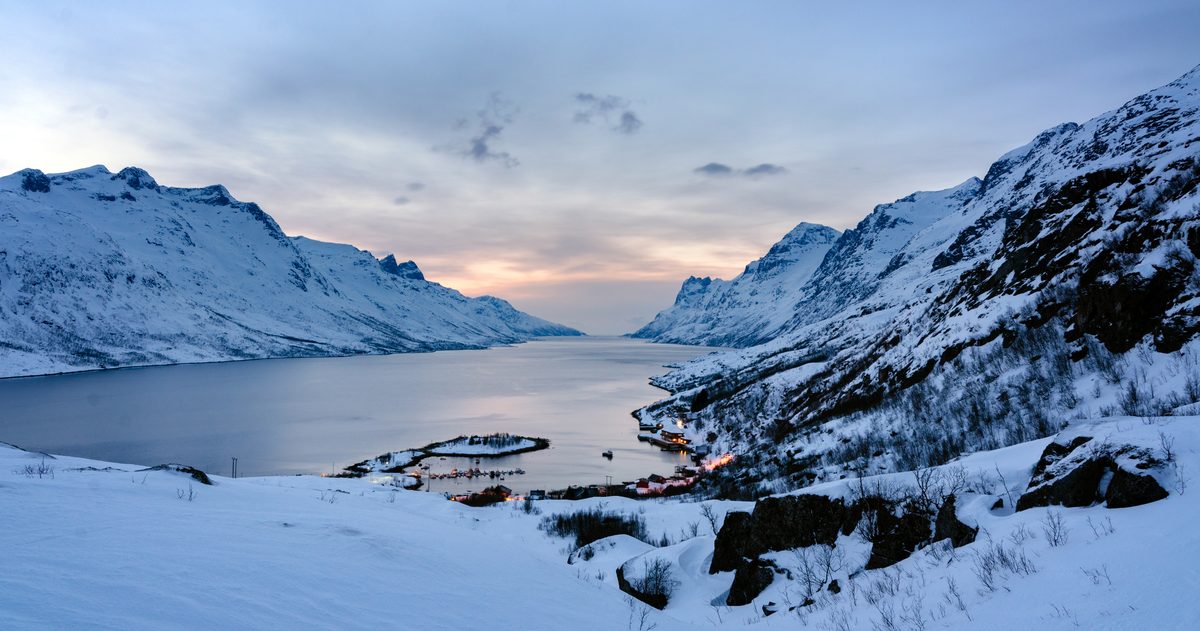
Finnish Lapland is the coldest of the three in winter: Rovaniemi averages a high of -7.3°C (19°F) and a low of -13.5°C (8°F) in January, and Saariselkä, further north, is about a degree colder by day and about two degrees colder at night. Tromsø, on the Norwegian coast, hovers around freezing with January highs of -1.0°C (30°F), and Reykjavík is milder again at 3.2°C (38°F). Daylight runs from none at all in Tromsø in late December to more than 11 hours everywhere by mid-March. For the aurora, cloud is the bigger obstacle than cold: winter skies over Iceland are on average about three quarters covered.
All temperatures here are official 1991-2020 station normals from the Finnish Meteorological Institute, MET Norway and the Icelandic Met Office, as submitted to the World Meteorological Organization. Sunrise and sunset come from the US Naval Observatory's astronomical calculations.
How cold is Lapland, Tromsø and Iceland in winter?
| Average high / low | December | January | February | March |
|---|---|---|---|---|
| Rovaniemi (airport, 189 m) | -4.9 / -10.6°C | -7.3 / -13.5°C | -7.3 / -13.3°C | -1.9 / -9.1°C |
| Saariselkä (tourist centre, 302 m) | -6.3 / -13.0°C | -8.3 / -15.6°C | -8.2 / -15.3°C | -3.2 / -11.7°C |
| Tromsø (city, 100 m) | 0.3 / -3.9°C | -1.0 / -5.3°C | -1.1 / -5.6°C | 0.6 / -4.4°C |
| Reykjavík (52 m) | 3.3 / -1.6°C | 3.2 / -1.7°C | 3.3 / -1.9°C | 4.2 / -1.3°C |
| Akureyri (23 m) | 2.6 / -3.6°C | 2.7 / -3.5°C | 2.6 / -3.6°C | 3.5 / -2.6°C |
The difference is not only the averages but how long the cold lasts. In January the temperature in Rovaniemi stays below 0°C all day on 28.4 days out of 31, and in Saariselkä on 29.5. In Reykjavík that happens on just 6.0 days, and in Akureyri on 9.5.
Extremes: the lowest temperatures in the 1991-2020 records were -38.6°C (-37°F) at Saariselkä and -38.1°C (-37°F) at Rovaniemi airport, both in January. Iceland's coast never gets close: Akureyri's lowest was -20.6°C (-5°F) in December, and Reykjavík's lowest from December to March was -14.9°C (5°F), in March.
Where you stay matters too. Rovaniemi's Apukka station (106 m) averages a January low of -17.0°C (1°F), against -13.5°C at the airport (189 m), so the temperature where you stay can differ from the airport figure by several degrees. Readers in the US can see Iceland in °F on our Iceland weather page and the Reykjavík forecast.
How many hours of daylight are there in winter?
Time from sunrise to sunset, from the US Naval Observatory, for the 2026-27 winter. It assumes a flat horizon, so hills and fells can hide the sun for longer.
| Sunrise to sunset | 21 Dec | 15 Jan | 15 Feb | 15 Mar |
|---|---|---|---|---|
| Rovaniemi | 2 h 14 min | 4 h 15 min | 8 h 10 min | 11 h 38 min |
| Saariselkä | no sunrise | 2 h 48 min | 7 h 45 min | 11 h 35 min |
| Tromsø | no sunrise | 38 min | 7 h 26 min | 11 h 33 min |
| Reykjavík | 4 h 07 min | 5 h 24 min | 8 h 37 min | 11 h 41 min |
| Akureyri | 3 h 04 min | 4 h 42 min | 8 h 21 min | 11 h 39 min |
In winter 2026-27 the sun does not rise at all in Tromsø from 28 November to 14 January, and in Saariselkä from 6 December to 6 January. That polar night is not pitch black: on 21 December Tromsø has civil twilight from 09:31 to 13:53, about 4 hours 20 minutes of blue, usable light. Actual sunshine is scarcer still. Reykjavík averages 12.6 hours of sunshine in the whole of December and Akureyri 0.3 hours, while Sodankylä, between Rovaniemi and Saariselkä, records 0.6 hours. By March the figures are 110.3, 77.9 and 140.8 hours.
How much snow is there?
Finnish Lapland has a deep, lasting snow cover. The Finnish Meteorological Institute describes winter there as about seven months long, with the ground typically snow-covered for over half the year, and the snow at its deepest in mid-March or, in Lapland, often in early April. Its 1991-2020 map puts the typical mid-March snow depth across most of Lapland at 60 to 80 cm (24 to 31 inches).
Iceland's coastal towns are far less reliable. Reykjavík averages 12.2 days with snow on the ground in January and Akureyri, in the north, 22.0. Tromsø is the wettest of the five, with 108.3 mm (4.3 inches) of precipitation on 15 days in January, more than twice Rovaniemi's 46.4 mm. We did not find an official snow-depth normal for Tromsø, so we do not quote one.
Is Iceland windy in winter?
Reykjavík is windier than Lapland, which changes how the cold feels; Akureyri in the north is not. Averaging the Icelandic Met Office's monthly values for 1991-2020, Reykjavík's mean wind speed is 5.1 to 5.5 m/s (11 to 12 mph) from December to March. Akureyri averages about 3.9 m/s (9 mph), as does Rovaniemi. A mean also hides the gusts, and wind makes any temperature feel colder on exposed skin. Our guides to the feels like temperature and to wind chill in US forecasts explain the numbers your app shows.
Reykjavík also sees rain or snow more often than Lapland: it averages 15.3 days with at least 1 mm of rain or snow in January, against 11.2 in Rovaniemi.
What does cloud cover mean for seeing the aurora?
The aurora forms 80 to 500 km (50 to 310 miles) above the ground, so any cloud between you and it blocks the view: NOAA says the skies must be clear and it must be dark. NOAA's Space Weather Prediction Center says the best place to watch is under an oval-shaped zone between about 60 and 75 degrees north, where the aurora can be observed on more than half the nights of a year. All five places in this guide lie between 64 and 70 degrees north.
That makes the weather the deciding factor. Winter cloud in Iceland averages 5.8 to 6.0 oktas in Reykjavík and 6.2 to 6.3 in Akureyri, where 8 oktas is a fully overcast sky. The official normals we used have no cloud figure for Rovaniemi, Saariselkä or Tromsø, so this guide cannot compare cloudiness between Lapland, Tromsø and Iceland. Do not assume Lapland has clearer skies. On many nights the question is not whether the aurora is there, but whether you can see it.
- Darkness: NOAA advises going out at night, away from city lights. A full moon dims how bright the aurora looks.
- Timing: the most active aurora is usually within an hour or two of midnight, between 10pm and 2am local time.
- Activity: on NOAA's Kp scale of 0 to 9, a Kp of 3 or 4 can give very nice displays if you are under the oval.
- March: NOAA notes a tendency towards larger geomagnetic storms near the equinoxes, but darkness shrinks quickly around the spring equinox.
How do you check the aurora and cloud forecast before you go out?
- Aurora activity: use NOAA's Space Weather Prediction Center or the Icelandic Met Office's aurora forecast, which shows expected activity at midnight on a 0 to 9 scale.
- Cloud in Iceland: the Icelandic Met Office's aurora page includes a cloud cover map that splits low, middle and high cloud and runs several days ahead. Green areas are cloudy and white areas are clear. The map covers Iceland only, so in Lapland and Tromsø use the model comparison below instead.
- Compare the models: our pages for Rovaniemi, Tromsø and Iceland show the European, American and German models side by side, including each model's sky description. When they split between clear and cloudy, treat a clear night as uncertain.
- Check again on the day: treat a clear sky forecast several days out as provisional. Our forecast accuracy by day page shows how forecast error grows with every day ahead (measured for temperature).
For deep cold and reliable snow, Lapland is the pick, with Saariselkä colder than Rovaniemi. Tromsø gives the longest polar night with milder, wetter weather, and Iceland the most daylight, but also more wind around Reykjavík and frequent cloud. Whichever you choose, plan aurora nights around the cloud forecast, not the calendar.