When Does US Hurricane Season Start and Peak?
The official dates, the mid-September peak, and why storms sometimes ignore the calendar.
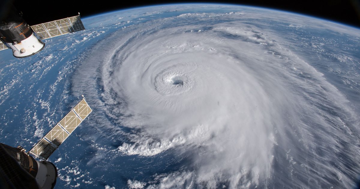
Atlantic hurricane season officially runs from June 1 to November 30, and it peaks around September 10. The overwhelming majority of activity falls between mid-August and mid-October, when ocean temperatures are warmest and atmospheric conditions are most favorable. The eastern Pacific season starts a bit earlier, on May 15, and also ends November 30.
When is Atlantic hurricane season?
The National Hurricane Center defines the Atlantic basin season (covering the Atlantic Ocean, Caribbean Sea, and Gulf of Mexico) as June 1 through November 30. These dates bracket roughly 97% of tropical activity in the basin. They aren't a hard on/off switch; they're a climatological window chosen to capture almost all storms while giving the public clear start and end points to prepare around.
When does it peak, and why mid-September?
The statistical peak of the Atlantic season falls around September 10. Two ingredients line up at that point in the calendar:
- Ocean heat is at its maximum. The Atlantic has spent all summer absorbing solar energy, so sea-surface temperatures reach their warmest in late summer and early fall: peak fuel for storms.
- Wind shear is often at a seasonal low. Disruptive upper-level winds tend to relax over the tropical Atlantic in this stretch, giving storms room to organize and strengthen.
Add in vigorous tropical waves rolling off Africa during this period, and mid-September becomes the sweet spot for storm formation.
What about the Pacific?
The United States watches more than one basin:
- Eastern Pacific: May 15 to November 30.
- Central Pacific (which affects Hawaii): June 1 to November 30.
The eastern Pacific starts two weeks earlier than the Atlantic, which is why the year's first named systems often appear off Mexico's west coast before the Atlantic gets going.
Month by month: how activity ramps up
| Period | Typical activity |
|---|---|
| June to July | Season opens; activity usually limited, often closer to home in the Gulf and western Caribbean |
| Early to mid August | Activity ramps up as the deep tropics become favorable |
| Late Aug to early Oct | Peak of the season; most major hurricanes form in this window, around the Sept. 10 climatological peak |
| Late October | Activity tapers but late-season storms remain common, often in the Caribbean and Gulf |
| November | Season winds down; storms are less frequent but still possible |
What counts as an "average" Atlantic season?
NOAA updates its baseline every decade using the most recent 30 years of data. Based on the 1991 to 2020 climate normals, an average Atlantic season now produces about 14 named storms, 7 hurricanes, and 3 major hurricanes (Category 3 or stronger). That average was revised upward from the previous 1981 to 2010 baseline of 12 named storms, 6 hurricanes, and 3 major hurricanes. When you hear a season called "above normal," it's being measured against these figures.
A named storm is any tropical or subtropical storm with sustained winds of at least 39 mph. It becomes a hurricane at 74 mph, and a major hurricane at 111 mph, Category 3 on the Saffir-Simpson scale.
Can storms form outside the official season?
Yes, occasionally. Tropical or subtropical systems sometimes develop in May before the June 1 start, and more rarely after November 30. Pre-season May systems have been common enough in recent years that forecasters watch the Atlantic closely by mid-spring. The official dates capture the vast majority of activity, but the atmosphere doesn't read a calendar, which is why the NHC monitors the basins year-round.
Where do storms typically form through the season?
The birthplace of Atlantic storms shifts as the season progresses, which is worth knowing if you live along the coast:
- Early season (June to July): systems tend to develop close to home (in the Gulf of Mexico, the western Caribbean, and off the US Southeast), often from old frontal boundaries rather than tropical waves.
- Peak season (mid-August to early October): the deep tropics light up. Long-tracked "Cape Verde" storms form from vigorous tropical waves near the Cape Verde Islands off West Africa and can traverse the entire Atlantic, giving them the most room to strengthen into major hurricanes.
- Late season (late October to November): formation shifts back toward the western Caribbean and Gulf as the deep-tropical activity fades.
This migration is why a quiet July says little about what the peak weeks may bring: the most dangerous storms often come from a part of the ocean that isn't even active early on.
Watches vs. warnings: know the terms
Whenever the season is active, two words carry very different meanings:
- Watch: conditions are possible within the specified area. A hurricane watch is typically issued 48 hours before tropical-storm-force winds are expected. Time to prepare.
- Warning: conditions are expected. A hurricane warning is typically issued 36 hours out. Time to act and complete preparations.
Separate storm surge watches and warnings exist too, because surge, the deadliest hurricane hazard, can threaten areas the wind forecast alone doesn't capture.
Staying ahead once a storm forms
Knowing the calendar helps you prepare early, but the decisions that matter come from the multi-day forecast once a system is being tracked. When the major models, the American GFS and European ECMWF, agree on where a storm is headed, confidence is high; when they split, the track is genuinely uncertain. checkweather.io lines those models up side by side and turns their agreement into a plain-English confidence score, so you can see how solid a forecast is rather than trusting a single track.
The bottom line
Mark June 1 to November 30 for the Atlantic, with the peak around September 10 and the busiest stretch from mid-August to mid-October. Prepare before the season starts, stay alert through the peak, and remember that storms can occasionally arrive outside the official window.
To see how the models actually line up, see which US forecast is most accurate.