When does New Zealand get frost?
Clear, calm winter nights under a high let heat escape to space - and inland South Island frost hollows like Central Otago turn that into the country's hardest frosts.
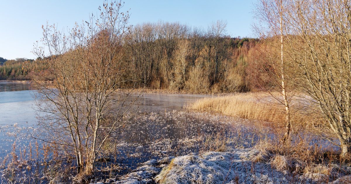
New Zealand gets frost mainly from late autumn through winter and into early spring, on clear, calm nights when a high-pressure system sits over the country. Under those conditions heat radiates away to space, temperatures near the ground fall below freezing, and dew turns to frost. Inland South Island basins - Central Otago above all - see the hardest and most frequent frosts, while mild northern coasts such as Auckland rarely frost at all.
What actually causes frost?
The most common type in New Zealand is radiation frost. On a clear, still night with no cloud blanket, the ground radiates its heat away to space and cools rapidly. The layer of air in contact with it cools too, and once the temperature drops to freezing the moisture in the air freezes onto surfaces as frost. Three ingredients make it worse: clear skies (no cloud to trap heat), light or calm winds (so cold air pools rather than mixing), and dry air (which cools faster). This is why frost and settled high-pressure weather go hand in hand.
The second type, advection frost, occurs when a mass of cold air is blown in behind a southerly, and can arrive even with some wind and cloud. Radiation frost is the more common household variety.
What is the difference between air frost and ground frost?
Meteorologists distinguish the two carefully:
| Type | Definition |
|---|---|
| Ground frost | The temperature at grass or surface level falls to 0 degrees or below. Common, and can occur even when the air temperature stays just above freezing. |
| Air frost | The air temperature measured in a standard screen, about 1.2 to 1.4 m above ground, falls below 0 degrees. A harder, more significant frost. |
Because the coldest air pools right at the surface on a calm night, you can get a ground frost - white lawns and iced car windscreens - while the official air temperature reads a degree or two above zero. A frost severe enough to register as an air frost is the more damaging one for plants and pipes.
When is frost season in New Zealand?
Frost risk builds as the nights lengthen and the sun weakens. In most regions the frost season runs from about May to September, peaking in June and July around the winter solstice. In the coldest inland South Island locations, frosts can occur well outside that window - late-autumn and early-spring frosts are a real hazard for horticulture. The key is not the calendar date but the weather pattern: any clear, calm night under a high in the cooler half of the year can deliver a frost.
Where does New Zealand get the worst frost?
Frost is intensely local, and topography rules. The coldest, frostiest places are inland South Island basins and valleys where cold air drains downhill on calm nights and pools with nowhere to escape - classic "frost hollows". Central Otago (around Alexandra, Ophir, Ranfurly and the Manuherikia and Ida Valleys), the Mackenzie Country and inland Canterbury lead the country for frost. New Zealand's official record low, according to NIWA, is minus 25.6 degrees at Ranfurly in July 1903 - a Central Otago frost hollow. By contrast, coastal and northern locations, moderated by the surrounding sea, get few frosts, and Auckland and the Far North may go a whole winter with barely any.
Why does frost matter so much for growers?
Frost is a major agricultural and horticultural hazard. A hard spring frost can destroy grapevine buds, kill fruit blossom and damage young crops, with real financial consequences in regions such as Marlborough, Hawke's Bay and Central Otago. This is why you will see large frost fans (wind machines) standing in vineyards and orchards: on a radiation-frost night they pull down slightly warmer air from just above the cold surface layer to protect the vines. Overhead sprinklers are also used, relying on the heat released as water freezes to keep buds just above the killing point. Accurate overnight minimum-temperature forecasts are therefore worth a great deal to growers.
How does MetService forecast frost?
MetService forecasts overnight minimum temperatures and highlights frost risk in its regional and rural forecasts, which growers, roading authorities and gritting crews rely on. The forecasting challenge is that the coldest frosts happen precisely when the atmosphere is at its calmest - and small differences in cloud cover, wind and low-level moisture can swing the overnight minimum by several degrees, the difference between a light ground frost and a damaging air frost.
That sensitivity is where comparing models earns its keep. For New Zealand, checkweather.io lines up the three global heavyweight models - ECMWF, NOAA's GFS and DWD's ICON - and turns their level of agreement on the overnight minimum into a plain-English forecast-confidence score, while linking through to MetService for the official forecasts. When all three drive the temperature well below zero, a hard frost is a safe bet; when they split on how much cloud will roll in overnight, the confidence score warns you the minimum is genuinely uncertain. An accuracy scoreboard then grades how each model's overnight lows stacked up against what was recorded.
The bottom line
New Zealand frost is a cool-season, clear-calm-night phenomenon, worst in the inland South Island frost hollows and mildest on the northern coasts. Know the difference between a ground frost and a damaging air frost, watch the overnight-minimum forecast, and - if you grow anything frost-tender - treat model agreement on that minimum as the number that matters most.
To judge how reliable this is, compare the New Zealand models side by side and see which New Zealand forecast is most accurate.