US Tornado Season: When and Where It Peaks
There is no single tornado season; the peak migrates north and east with the calendar, and two regions dominate the map.
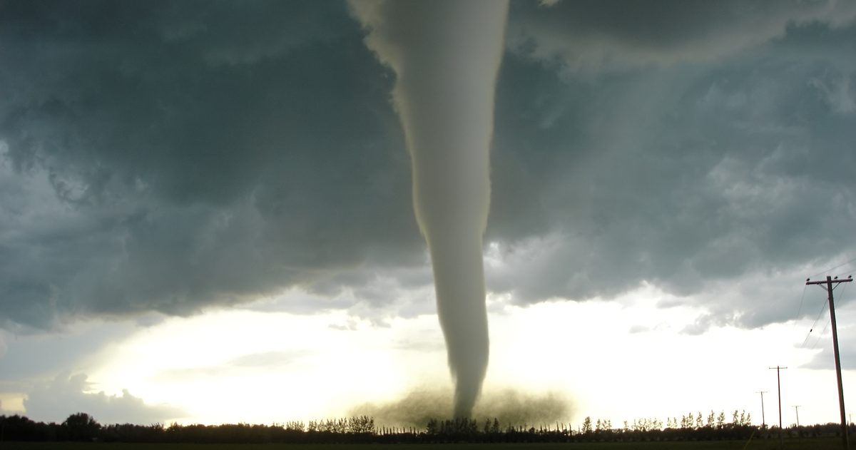
US tornado activity peaks in spring, generally April through June, and shifts geographically through the year. The southern Plains ("Tornado Alley") is most active from April into June, while the Southeast ("Dixie Alley") sees a peak in spring and a second uptick in fall. As summer arrives, the maximum drifts north into the northern Plains and upper Midwest.
Is there really a tornado "season"?
Not a fixed one. Tornadoes have occurred in every US state and in every month, but they cluster when warm, moist Gulf air, a strong jet stream and a triggering front come together. That overlap is most common in spring, which is why national tornado counts climb sharply from March, peak around April to June, then taper. The peak is really a moving target that migrates across the country as the season progresses.
Tornado Alley vs Dixie Alley: what's the difference?
Both are informal nicknames, not official National Weather Service boundaries, but they describe real climatological hot spots:
| Feature | Tornado Alley | Dixie Alley |
|---|---|---|
| Rough location | Southern/central Plains: TX, OK, KS, NE and nearby | Southeast: MS, AL, LA, TN, AR, GA |
| Peak timing | April to June | Spring, with a secondary fall peak |
| Terrain / visibility | Open, flat, tornadoes often visible | Trees and hills, rain-wrapped and hard to see |
| Timing of day | Often afternoon/evening | More nighttime tornadoes |
| Housing exposure | Fewer manufactured homes | More manufactured homes, higher vulnerability |
Dixie Alley is often considered more dangerous for a given tornado because storms there are more likely to strike at night, be hidden by rain and trees, and hit vulnerable housing, factors tied to higher fatality rates even when tornado counts are lower.
When does the peak move through the year?
- Winter (Dec to Feb): lower counts overall, but the Gulf Coast and Deep South can see outbreaks with the right setup.
- Spring (Mar to May): activity ramps quickly; the southern Plains and Southeast are most active.
- Early summer (Jun): often the single most active month nationally, with the focus shifting to the central and northern Plains.
- Mid-to-late summer (Jul to Aug): the maximum lifts into the northern Plains and upper Midwest as the jet stream retreats north.
- Fall (Oct to Nov): a secondary Southeast peak as stronger jet-stream systems return south.
What ingredients make a tornado day?
Forecasters look for several ingredients coming together, often summarized as instability, lift, moisture and shear:
- Moisture: warm, humid air, usually streaming north from the Gulf of Mexico, fuels thunderstorms.
- Instability: warm air near the surface under cooler air aloft lets storms build tall and strong.
- Lift: a front, dryline or other boundary to kick air upward and start storms.
- Wind shear: winds changing speed and direction with height, which lets a storm's updraft rotate and become a supercell, the type most likely to produce strong tornadoes.
Spring is prime time in the Plains because that is when strong jet-stream winds still overlap with the season's first surges of Gulf moisture and instability. By midsummer the jet stream lifts north and weakens over the southern Plains, shifting the risk with it.
Has "Tornado Alley" been shifting?
Some studies have noted an eastward tendency in tornado activity over recent decades, with relatively more events across the Mid-South and Southeast and relatively fewer in the traditional southern Plains core. Researchers are still examining the causes and the long-term significance, so treat this as an area of active study rather than a settled conclusion. What is clear is that damaging tornadoes are far from confined to the classic Plains "alley."
Watch vs warning: know the difference
These two NWS terms are easy to mix up and the distinction matters:
- Tornado Watch (issued by the Storm Prediction Center): conditions are favorable for tornadoes across a broad area over the next several hours. Stay alert and review your plan.
- Tornado Warning (issued by your local NWS office): a tornado is occurring or imminent, indicated by radar or spotters, for a specific area. Take shelter now.
A Particularly Dangerous Situation (PDS) tag can be added to watches when an outbreak of strong, long-track tornadoes is expected.
How are tornadoes rated?
Since 2007, US tornadoes have been rated on the Enhanced Fujita (EF) Scale, from EF0 to EF5, based on the damage they cause, which is used to estimate wind speeds. The rating is assigned after a ground survey, not from radar in real time, so a tornado's final EF number typically comes out in the hours or days afterward.
How can you stay ahead of tornado days?
Start with the Storm Prediction Center's convective outlooks, which rate severe-weather risk days in advance (from Marginal up through High), and keep a way to receive warnings that will wake you at night, a NOAA Weather Radio or Wireless Emergency Alerts on your phone. For the day-to-day forecast around a severe setup, checkweather.io lets you compare the GFS and ECMWF models on timing and location and shows a forecast-confidence score, so you can see whether the models agree on when the risk arrives. No black boxes.
To see how the models actually line up, see which US forecast is most accurate.