New Zealand winter and snow: what to expect
Southern Hemisphere winter brings Antarctic southerlies, low-level South Island snow and mountain snowfalls in the North - with MetService snow and road warnings to match.
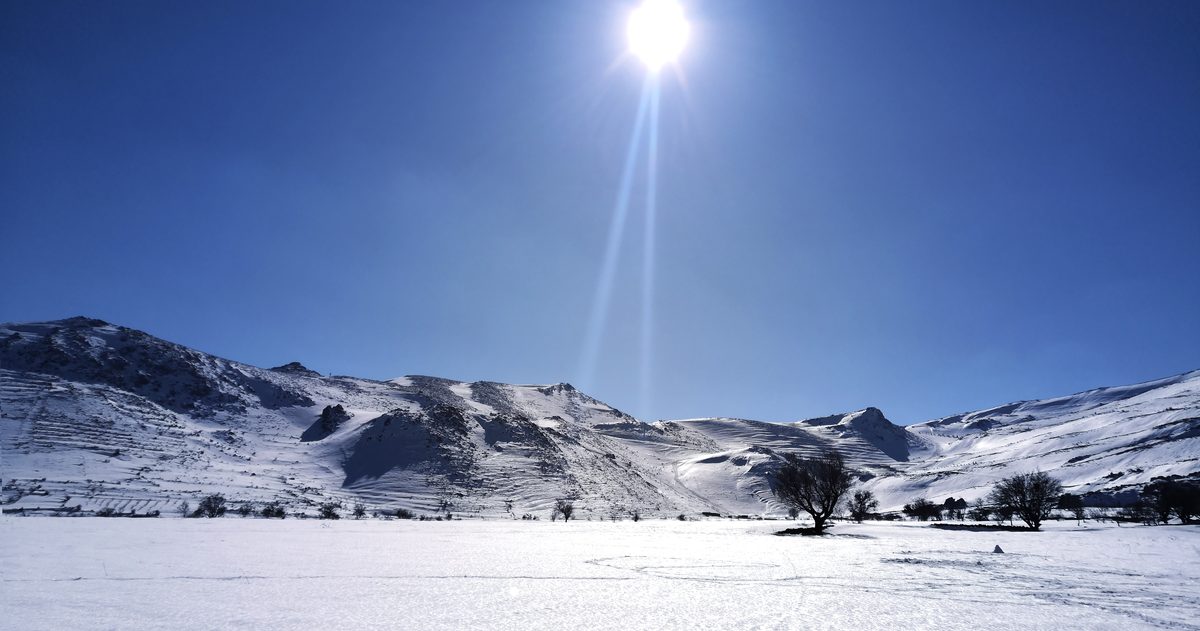
New Zealand's winter runs from June to August. Expect frequent southerly changes that drag cold air up from the Southern Ocean and Antarctica, snow to low levels in the South Island - especially the Southern Alps, Canterbury high country and Central Otago - and snow largely confined to the mountains in the North Island. MetService issues Snow Warnings, Snow Watches and Road Snowfall Warnings when settling snow threatens communities and highways.
When is winter in New Zealand?
Because New Zealand sits in the Southern Hemisphere, its seasons are the reverse of Europe and North America. Meteorological winter covers June, July and August, with the coldest conditions typically from mid-June through July. The astronomical winter solstice - the shortest day - falls around 21 June. Cold snaps can, however, arrive either side of that window: sharp southerlies are possible from late autumn into early spring.
Why does New Zealand get cold in winter?
The dominant driver of New Zealand's coldest weather is the southerly. When a low to the east and a high to the west line up, the flow between them drags air northward straight off the Southern Ocean and, at its most extreme, from the Antarctic sea-ice edge. These "southerly blasts" bring a sudden temperature drop, squally showers turning to snow at surprisingly low levels, and biting wind chill. The South Island, closest to that cold source and shielded by no landmass to its south, feels it first and hardest.
Between these outbreaks, winter also delivers long settled spells under high pressure. These bring the country's sharpest frosts and, in sheltered basins, persistent fog and low cloud that can sit for days.
Where does it actually snow?
Snowfall in New Zealand is strongly geographic:
- Southern Alps and Main Divide: heavy, reliable snow through winter - the foundation of the South Island ski fields.
- Canterbury and Otago high country and inland basins: Central Otago, the Mackenzie Country and inland Canterbury regularly see settling snow to valley floors during southerlies and cold southeasterlies.
- Southland and coastal South Island: lowland and even coastal snow is possible in strong outbreaks, though it often does not lie for long.
- North Island mountains: Ruapehu, Tongariro and the Central Plateau, plus the Kaimanawa and Kaweka Ranges, hold winter snow; the Desert Road (State Highway 1) is regularly closed by it.
- North Island lowlands: settling snow at low levels is rare and newsworthy.
What does MetService warn for?
MetService uses a tiered system for winter hazards. A Watch means severe conditions are possible; a Warning means they are expected. Warnings carry colour severity - Orange for significant events and Red reserved for the most extreme, high-impact situations. The key winter products are:
| Product | What it covers |
|---|---|
| Snow Warning / Watch | Significant settling snow affecting communities, often to a stated level (e.g. above 400 m) |
| Road Snowfall Warning | Snow expected to settle on specific alpine highways and passes |
| Severe Wind / Heavy Rain | Frequently accompany winter fronts and southerly changes |
Alpine passes such as the Milford Road, the Crown Range, the Lindis Pass, Arthur's Pass and the Desert Road are the routes most often affected, and MetService road warnings are worth checking before any winter journey through them.
How cold does a New Zealand winter get?
New Zealand's official record low, recorded by NIWA, is minus 25.6 degrees at Ranfurly in Central Otago in July 1903 - inland Otago's frost hollows are the coldest inhabited places in the country. For most people, though, winter means daytime highs in the single digits to low teens and hard overnight frosts inland, rather than extreme cold. Coastal North Island centres such as Auckland rarely see frost at all and almost never lie snow.
Does El Nino or La Nina change the winter?
Yes - the background climate driver tilts the odds. El Nino winters tend to bring more southerly and south-westerly flows to New Zealand, raising the chance of cold outbreaks and mountain snow, while La Nina winters lean milder and more north-easterly. NIWA's seasonal climate outlook translates these signals into regional probabilities each season. As always, they shift the odds rather than dictating any individual storm.
How far ahead can you trust a snow forecast?
The arrival of a cold southerly is usually well-signalled several days out, but the details that matter most - the snow level, and whether snow settles at 200 m or only above 600 m - hinge on precise temperature profiles that can swing a forecast from "a dusting" to "roads closed". This is where the global models often disagree.
checkweather.io is built for exactly that uncertainty. It compares the three global heavyweight models - ECMWF, NOAA's GFS and DWD's ICON - for New Zealand, and converts their level of agreement into a plain-English forecast-confidence score, while linking through to MetService for the official snow and road warnings. When the models agree on a low snow level, confidence is high; when they split on where rain turns to snow, the score tells you to hold off on firm travel plans. An accuracy scoreboard then grades how each model performed against what actually fell.
The bottom line
A New Zealand winter is a story of southerlies off the Southern Ocean, reliable alpine snow, low-level South Island snowfalls and mountain-only snow in the North. Plan around MetService warnings, respect the alpine passes, and treat the snow level - not just the fact of snow - as the number that really matters.
If accuracy matters to you, see which New Zealand forecast is most accurate.