Hurricane Season 2026: What the Models Are Signaling
Seasonal outlooks are about odds and ingredients, not named storms. Here's how to read the 2026 signals without falling for hype.
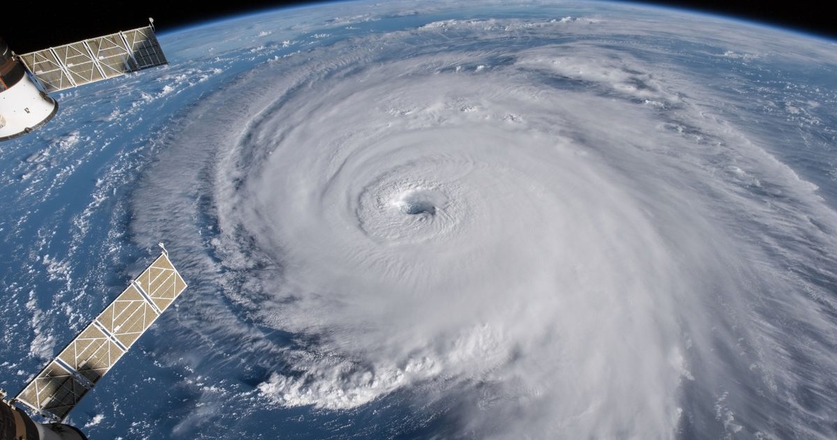
No credible forecaster can tell you in advance which storms will form in 2026 or where they'll hit. What seasonal outlooks actually assess is the ingredients: the ENSO state (El Niño or La Niña), how warm the tropical Atlantic is, and how much wind shear is expected. The authoritative numbers come from NOAA's Climate Prediction Center, which issues its Atlantic outlook in late May and updates it in early August. That's where to look, not at viral single-storm predictions.
What actually drives a season outlook?
An Atlantic hurricane season is a competition between conditions that help storms and conditions that suppress them. Three ingredients dominate:
- ENSO state: whether the tropical Pacific is in El Niño, La Niña, or neutral conditions.
- Ocean heat: sea-surface temperatures across the tropical Atlantic and Caribbean, the fuel for storms.
- Wind shear: the change in wind speed and direction with height, which can tear developing storms apart.
Seasonal forecasters weigh these ingredients to estimate a range of named storms, hurricanes, and major hurricanes, along with the odds of an above-, near-, or below-normal season. They do not, and cannot, forecast individual landfalls months ahead.
ENSO: the single biggest seasonal signal
The El Niño-Southern Oscillation (ENSO) is the swing between warmer (El Niño) and cooler (La Niña) sea-surface temperatures in the tropical Pacific. It matters for the Atlantic because of what it does to wind shear thousands of miles away:
- La Niña tends to reduce vertical wind shear over the tropical Atlantic, making the environment more favorable for storms, often nudging seasons toward more activity.
- El Niño tends to increase Atlantic wind shear, which can disrupt storms and suppress activity.
For 2026, the practical move is to check the CPC's current ENSO status and its ENSO advisory rather than assuming a state. ENSO evolves through the year, and the season outlook hinges heavily on whether La Niña, El Niño, or neutral conditions are expected during the peak months of August through October.
Why ocean heat matters
Hurricanes are heat engines. They draw energy from warm ocean water, generally needing sea-surface temperatures around 80°F (about 26°C) or higher through a sufficient depth. When the tropical Atlantic and Caribbean run warmer than average, more of that fuel is available and storms can intensify more readily, provided shear and other factors cooperate. A warm Atlantic is one reason a season can be active even when ENSO is neutral.
What the 2026 outlooks will tell you, and when
Two well-known sources anchor the season:
| Source | What it provides | Timing |
|---|---|---|
| NOAA Climate Prediction Center | Official Atlantic outlook: ranges for named storms, hurricanes, major hurricanes, and the probability of an above/near/below-normal season | Issued late May; updated in early August |
| Colorado State University (CSU) | Widely cited academic seasonal forecast, updated through the season | Initial forecast in spring, with updates |
| NOAA National Hurricane Center | Real-time tracking and forecasts once storms form (not a seasonal count) | Throughout the season |
When these outlooks land, read the range and the probability, not a single headline number. "12 to 17 named storms" is a forecast of uncertainty, not a promise of a specific count.
Why you can't predict individual storms months out
The same chaos that limits everyday forecasts to about a week applies with even more force to naming where a storm will strike in September when it's still spring. Individual storms depend on small-scale features (tropical waves, pockets of dry air, day-to-day shear) that simply don't exist yet. Any "map" claiming to show specific 2026 landfalls months ahead is not science; it's clickbait.
What about dust, the MJO, and other wildcards?
ENSO, ocean heat, and shear are the headline ingredients, but a few shorter-term factors shape when a season is busy or quiet:
- Saharan dust: vast plumes of dry, dusty air blow off Africa across the Atlantic, especially in early summer. This dry air and the shear associated with it can smother developing storms, one reason June and July are often quieter.
- The Madden-Julian Oscillation (MJO): a pulse of enhanced and suppressed thunderstorm activity that circles the tropics over roughly 30 to 60 days. When its active phase moves over the Atlantic, it can favor bursts of storm development; when the suppressed phase arrives, activity often stalls.
These operate on timescales of days to weeks, so they help explain the rhythm within a season rather than the seasonal total. Seasonal outlooks can't pin them down months ahead, which is another reason to treat a single pre-season number as a range, not a forecast of exactly when storms will come.
Seasonal outlook vs. the forecast you'll actually use
A seasonal outlook helps you decide whether to review your hurricane plan and supplies early. But the forecasts that matter for evacuation and safety come days out, once a system exists and the NHC is tracking it. That's the window where model comparison earns its keep: when the GFS and ECMWF agree on a track, confidence is high; when they diverge, it's genuinely uncertain. checkweather.io lines those models up side by side and scores their agreement so you can see how much trust the forecast deserves, rather than reacting to a single track line.
The bottom line
For 2026, watch the ingredients (ENSO, Atlantic warmth, and shear) and wait for NOAA's late-May outlook and its August update for the official numbers. Prepare based on the odds, and save your close attention for the multi-day forecasts once real storms form.
To see how the models actually line up, see which US forecast is most accurate.