Canadian tornado season: when and where
Canada records more tornadoes than any country except the United States. The season peaks from June through August, concentrated across the southern Prairies and southern Ontario - the two zones sometimes called Canada's tornado alleys.
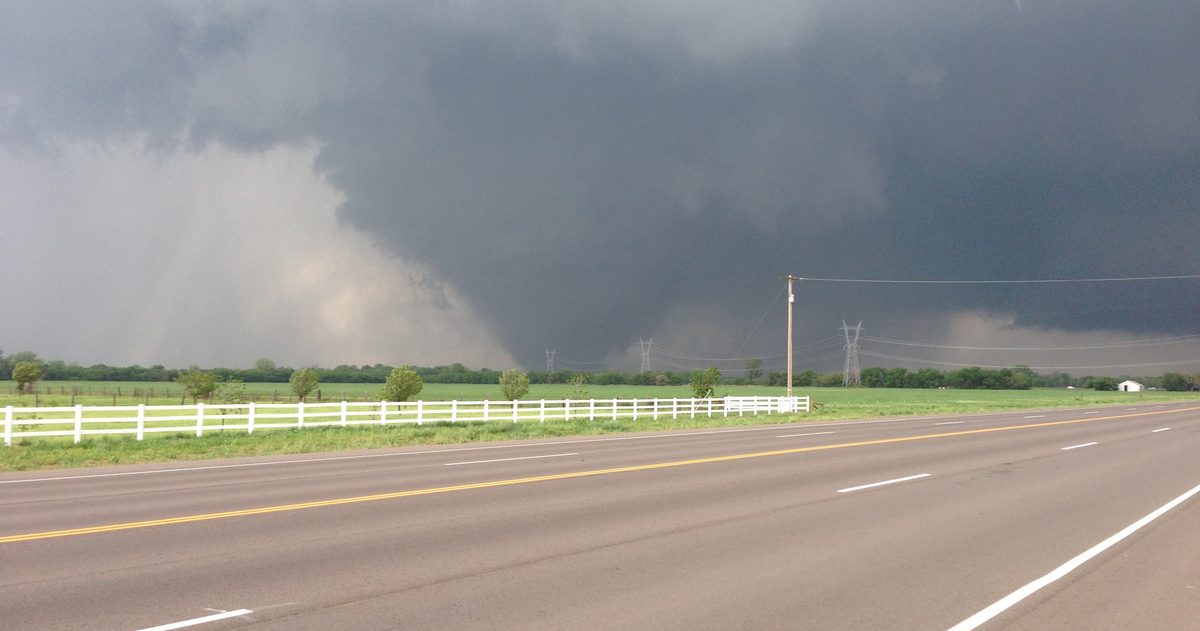
Canadian tornado season runs mainly from June through August, with a broad window from spring into early autumn. Most tornadoes strike two regions: the southern Prairies (parts of Alberta, Saskatchewan and especially southern Manitoba) and southern Ontario, extending into southern Quebec. Canada records more tornadoes than any nation except the United States - the ingredients are the same, just less frequent and generally weaker.
When is tornado season in Canada?
Tornadoes need warmth, moisture and atmospheric instability, so they cluster in the warm season. Activity can begin in spring and linger into September or October, but the clear peak is mid-summer, June to August, when the atmosphere is most unstable and moisture is at its highest. Within a day, the danger window skews to the late afternoon and evening, after the sun has heated the surface and destabilised the air. That said, tornadoes can and do occur outside these windows, which is why watches and warnings matter more than the calendar.
Where do tornadoes happen most?
Two corridors stand out:
- The southern Prairies. Southern Manitoba, southern Saskatchewan and parts of Alberta see frequent summer thunderstorms fed by warm, moist air pushing north and drier air off the Rockies. Southern Manitoba in particular is one of Canada's most active tornado zones.
- Southern Ontario and southern Quebec. The Windsor-to-Ottawa corridor, including the areas around London, Barrie and the Greater Toronto Area, sees a genuine tornado threat each summer as humid air from the south collides with passing cold fronts.
Smaller numbers occur in interior British Columbia, the Atlantic provinces and occasionally the North. A key point highlighted by Western University's Northern Tornadoes Project (NTP): many Canadian tornadoes historically went undetected because they touched down in remote or sparsely populated areas. As detection has improved, Canada's official tornado counts have risen - not because there are suddenly more storms, but because we are finally seeing the ones that were always there.
How are tornadoes rated in Canada?
Canada uses the Enhanced Fujita (EF) scale, which runs from EF0 to EF5 and estimates a tornado's intensity from the damage it causes. Most Canadian tornadoes are weak (EF0 to EF1), but violent ones do occur.
| Rating | Estimated wind (km/h) | Typical damage |
|---|---|---|
| EF0 | ~105 to 137 | Minor: branches down, shingles peeled, sign damage |
| EF1 | ~138 to 177 | Moderate: roofs stripped, mobile homes overturned |
| EF2 | ~178 to 217 | Considerable: roofs torn off, large trees snapped |
| EF3 | ~218 to 266 | Severe: well-built homes badly damaged |
| EF4 | ~267 to 322 | Devastating: houses levelled |
| EF5 | >322 | Incredible: strong homes swept away |
Wind ranges are the standard EF-scale estimates used in Canada; ratings are assigned by ECCC and NTP damage surveys after the fact.
What are Canada's most notable tornadoes?
History underlines that the threat is real. The Regina Cyclone of 30 June 1912 remains Canada's deadliest tornado, killing 28 people. The Edmonton "Black Friday" tornado of 31 July 1987 killed 27 and was rated at the top of the scale. Other significant events include the Barrie, Ontario tornado of 31 May 1985 and the Pine Lake, Alberta tornado of 14 July 2000. Each landed squarely in the regions and season described above.
What is the difference between a watch and a warning?
ECCC issues two key alerts:
- A tornado watch means conditions are favourable for tornadoes to form - stay alert and keep an eye on the sky and your alerts.
- A tornado warning means a tornado has been detected or is imminent - take shelter immediately in the lowest, most interior part of a sturdy building, away from windows.
Warnings are also pushed through Canada's Alert Ready system to compatible mobile phones, radio and TV. Because tornado warnings often come with only minutes of lead time, having a plan before the season starts is what saves lives.
Why does Canada get fewer tornadoes than the United States?
The ingredients are identical on both sides of the border - warm, moist air, instability, wind shear and a lifting trigger - but Canada sits farther north, where the warm, humid air from the Gulf of Mexico that fuels the U.S. Great Plains arrives less often and less intensely. The severe-weather season is also shorter here. That is why Canadian tornadoes are, on average, fewer and somewhat weaker than the worst American events, even though the southern Prairies and southern Ontario share the same basic setup as the northern edge of "Tornado Alley." It is a difference of frequency and intensity, not of physics - which is exactly why the threat must still be taken seriously every summer.
How do meteorologists spot tornado risk?
Forecasters watch for the classic ingredients - instability, moisture, wind shear and a trigger like a cold front - then monitor storms in real time with weather radar. ECCC's dual-polarization radar network can detect rotation and even the debris signature of a tornado on the ground, sharpening warnings. On the days-ahead side, comparing how the ECCC GEM, ECMWF and GFS models handle the setup is exactly the kind of side-by-side view checkweather.io turns into a confidence score - so when the models agree a severe-weather day is coming, you know the signal is solid rather than a single model's guess.
How can you stay safe during tornado season?
Know your region's risk, turn on weather alert notifications in ECCC's WeatherCAN app (tornado warnings also reach phones automatically through Alert Ready), and identify your shelter spot in advance - a basement or an interior room on the lowest floor. When a warning is issued, act first and check the details later. Minutes matter, and the season's peak in June, July and August is the time to have the plan ready.
Rather than trust a single forecast, see which Canadian forecast is most accurate.