Australian severe thunderstorms and hail
From BOM's 2 cm hail threshold to the supercells that batter the east coast, here is how Australia's most damaging storms form and where they strike hardest.
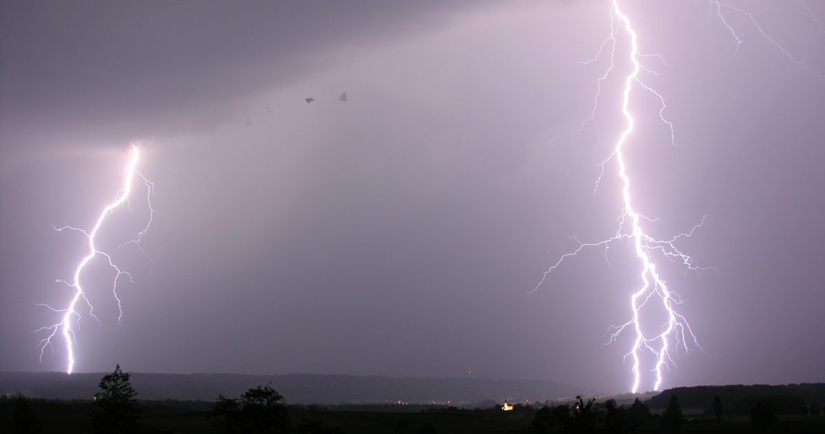
Severe thunderstorms are Australia's most frequent source of damaging weather. The Bureau of Meteorology (BOM) classes a storm as "severe" when it produces hail 2 cm or larger, wind gusts of 90 km/h or more, flash flooding, or a tornado. They peak in spring and summer along the eastern seaboard, and south-east Queensland and north-east New South Wales form the country's busiest hail corridor.
What makes a thunderstorm "severe"?
Ordinary thunderstorms are common across Australia in the warm months, but only a fraction reach BOM's severe threshold. A storm is officially severe if it produces any one of the following:
- Hailstones 2 cm or larger in diameter (about golf-ball size at 4 cm, and "giant hail" at 5 cm or more);
- Wind gusts of 90 km/h or more;
- Heavy rainfall likely to cause flash flooding;
- A tornado.
When any of these is expected, BOM issues a Severe Thunderstorm Warning. These are among the most time-critical warnings the Bureau produces, because a supercell can go from a distant tower of cloud to giant hail overhead in well under an hour.
What are the four ingredients of a severe storm?
Forecasters look for four things coming together:
- Instability: warm, buoyant air near the surface beneath colder air aloft, measured as CAPE (Convective Available Potential Energy). This is the fuel.
- Moisture: humid low-level air, often drawn in off the Coral or Tasman Seas, providing the water for heavy rain and hail.
- Lift: a trigger such as a trough, cold front, sea breeze or mountain range to kick the air upward.
- Wind shear: a change in wind speed and direction with height, which tilts and organises a storm so it can sustain itself for hours.
Weak shear tends to give short-lived "pulse" storms. Strong shear combined with high instability is the recipe for the most dangerous storms of all: supercells.
What is a supercell?
A supercell is a thunderstorm with a deep, rotating updraught called a mesocyclone. That rotation lets the storm balance rain and updraught so it does not choke itself off, allowing it to persist for hours, track for hundreds of kilometres and produce the worst weather: giant hail, destructive winds and, occasionally, tornadoes. Supercells are relatively rare in Australia compared with the American Midwest, but the east coast produces several each season.
Where and when is Australia's hail alley?
Severe thunderstorms are most common from spring into early autumn, roughly October to March, when the atmosphere holds the most heat and moisture. The eastern seaboard is the hotspot, and the corridor from south-east Queensland through north-east New South Wales (taking in Brisbane, the Granite Belt, the Northern Rivers and the ranges inland of the coast) is Australia's busiest region for large hail. Sydney and the New South Wales tablelands are also frequently hit. The Sydney hailstorm of 14 April 1999, which dropped giant hail across the eastern suburbs, remains one of Australia's costliest natural disasters and a reminder that the season can stretch into autumn.
What about damaging winds and downbursts?
Hail is only one face of a severe storm. Some of the worst wind damage comes from a downburst: a sudden, powerful rush of air that slams down out of a storm and spreads out violently when it hits the ground. Downbursts can produce gusts well above 90 km/h and flatten trees and roofs across a broad path, and because the damage is straight-line rather than twisting, they are often mistaken for tornadoes. When many storm cells line up along a front, they can form a squall line that delivers a long, continuous band of damaging wind and heavy rain as it sweeps through. These wind events are a major reason the east and south of the country take severe-storm warnings so seriously.
How does giant hail form?
Hail grows inside a storm's powerful updraught. Supercooled water droplets freeze onto a hailstone, which is then carried up and down through the storm, gathering layer after layer of ice. The stronger the updraught, the longer a stone can stay aloft and the bigger it grows before its weight finally drops it to the ground. That is why the most intense, well-organised storms, supercells with the strongest updraughts, produce the largest, most damaging hail.
How do you read the warnings and the models?
BOM's Severe Thunderstorm Warnings, backed by its live rain-radar network, are the frontline tool once storms are firing. Ahead of time, though, the value is in gauging how confident the outlook is. At checkweather.io we compare ECMWF (European), NOAA's GFS (American) and DWD's ICON (German) side by side and turn their agreement into a plain-English forecast confidence score. Convection is inherently harder to pin down than a heatwave (the models can agree that conditions are ripe without agreeing exactly where a storm will fire), so a lower confidence score on a storm day is honest information, not a failure. For live warnings and radar we link straight through to the Bureau of Meteorology.
How should you stay safe in a severe storm?
When a Severe Thunderstorm Warning is issued, move cars under cover to protect them from hail, bring outdoor furniture inside, and stay indoors away from windows. Never drive through floodwater: "if it's flooded, forget it". Unplug sensitive electronics, and if you are caught outdoors, get inside a building or hard-topped vehicle well before the storm arrives, because lightning can strike ahead of the rain.
To judge how reliable this is, see which Australian forecast is most accurate.